

VR GIS
[DTM Version 1.10 released: September, 2006]
This page updated: February, 2011
DTM™ Digital Terrain Mapping
- Digital Terrain Mapping (DTM): Import Digital Elevations and display as a 2D map or 3D View. Program requires Borland BDE (to print the Ecotype Color Chart) and a OpenGL® capable card. DTM is an extension of the GL Scene Height Terrain Field (HTF) utility by Eric Grange combined with many of the other demos and ideas of mine.
- The relation between this (DTM) - Fractal 3D - and SOS MAP is continually changing, however there is an overlap in the programs functionality. Fractal 3D creates fractal landscapes and sundry other images-objects ...DTM... SOS MAP Surreal Object Synthesis Multimedia Analysis Product performs Analysis of data and Synthesis of the results into a new product.
- DTM is a data importer-compressor-previewer. Digital Elevation Models (DEM) provide a base for 3D surficial overviews of natural resource data. 3D views of Caves, Mines, geological depth,... are normally site specific rather than areal and would require individual data. DTM has 2D overlays and 3D objects placed on 3D Terrain per .shp file data. [Shift] Left clicking on a displayed HTF will launch a 3D GL viewer of that Single tile; [Shift+Alt] Left displays a 3D view of all tiles on the screen; [Shift+Ctrl] Left displays a 3D LOD ROAM view starting at the clicked location and movable around the entire HTF area (all textured with the 2D texture .. see Program options); [Alt] Left autosaves a snapshot of the screen. See the programs Help for detailed information on functionality, procedures and processes.
- New to Version 1.9: Bug fixes.
- New to Version 1.8: Bug fixes and changes of 2005
- New to Version 1.7:
- Archeology Material Visualization will be the Demo-Tutorial Subject. HTF, Shape, 3ds, texture, etc... files will be available to be loaded using the Demo DTP Project files.
- Revision of the Commands that Shape objects can be linked to [DTP Phase 2] led to Point, Line, Area, Text, Object (PLATO) types having Path, Action, or Evolving capabilities. Digital Terrain Project (DTP) form contains the input areas and File Load-Save procedures.
- The GLSViewer added LightMap processing per Marcus and the 3D LOD ROAM viewer uses the ModelManager by Blaise Bernier to load proxies of the 3D Shape Objects.
- GLS Tree and TReal added to Tools.. along with L System, Mathings, Fractal, Fractal Plus
- Added some code from Fractal3D (Math page: Random +Bumps DLA, Population and Strange Attractors, with Turtles on their own form) ... Strange Attractors do not translate into 3D very well... most require a million points to display as a shape in a 2D 640x480 image, so the 3D is rather sparse as a million 3D points is too much. Will try to get the Fractal stuff working... it will display as 2D and 3D... like it does in Fractal3D. Was thinking this (DLA, Turtles) would become part of the Evolve code... now i am not so sure.
- DTM Revision broke the VR GIS Drone capability... Need to Revise All programs to be Drone capable.
- LatLong Grid: deleted from Menu.. it was never implemented. A Shape file can be loaded that displays Grid lines... Much simpler than trying to make an input form to handle all possible situations.
- [Version 1.6 released: October, 2004]: Some Tools moved..copied to..from Tongs™. The .bit elevation data file stucture has changed from the old .bit (.bit header only.. the files should still compile into a .htf using a .tpcfg file) (.bin files are the same... just data with no header). Reworked all forms in the debugging process.
- Additions to the 3D Terrain viewer: Bumpmap Sunlight..elevation tint generation and a procedure to make the little guy run to where the Terrain is clicked (ala Stuart Gooding). Moving Sun, Ocean (ala skinhat) with Raindrops (Waterplane), Clouds (ala Tobias Peirick and J.Joenson), and Storm Clouds (ala Marcus). Shape files (.shp) can be loaded and displayed as 3D objects. ... still setting it up ... see the original GLScene demos for correct implementation.
- Filled in the rest of the HTF Pack DEM buttons (Zipped SRTM and Canada DEM files are automatically unzipped-processed and interim files deleted), Added a Zip..Unzip to Tools.
- Working on DTP Phase 2 Paths; Action, Evolving, etc are under construction (just organizing thoughts). The Path Gizmo (ala Arvydas Juskevicius aka adirex) is combined with a GLScene demo to make a 3D Path Editor.
- DTM is now VR GIS™ Drone capable. VR GIS™ Task Commander is used to assign tasks to [networked] computers using Internet Direct (Indy) networking code. A Tachyon Unit program is run as a Drone on the [networked] computer to perform the tasks. Drone Capable: Able to be tasked over the network by VR GIS™.

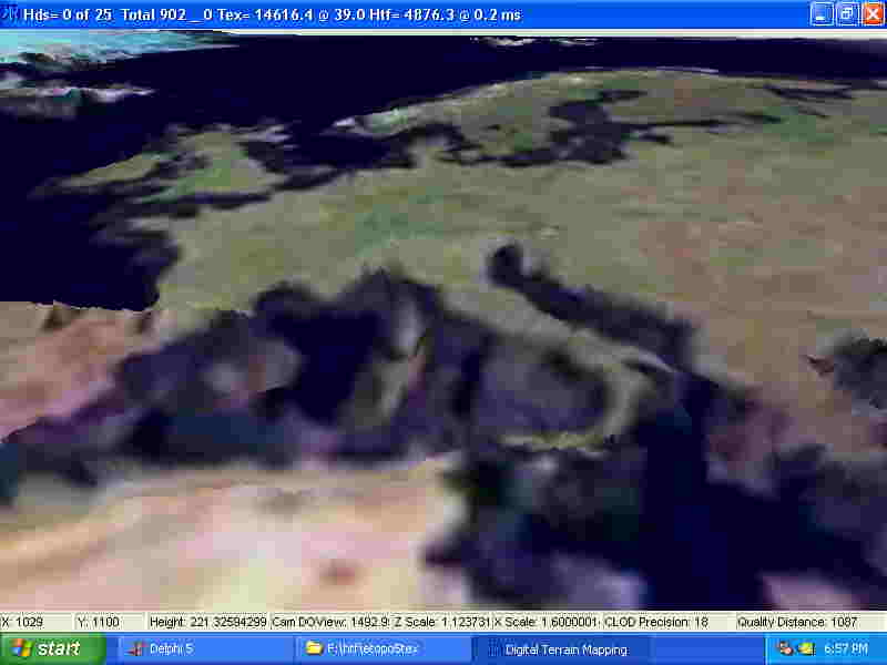
The elevation data is from Etopo5 and the Landsat composite image overlay is from NASA. Please excuse the jpg scrunching. Your times may vary depending on computer, texture type..density, and other variables :)
- [Version 1.5 released: January, 2004] New data readers: SRTM -1 and -3, SDTS, DEM 1/24k, DTED, NED BIL and Gridfloat. Autorange palette. Roam 3D Terrain Viewer (HTF HDS).
- New to Version 1.4: mostly bug fixes, changed back to using tdbf for most Dbase files (Need Borland BDE to print the Ecotype Color Chart). Changed 3D viewer and Image Maker. Ecotype and 3D project files still need work and there is no actual Geographic transformation capability in DTM.

- New to Version 1.3: Improved Overlay Polygon (Transparent) and Lines (Stippled) use of GR32 procedures. Implemented Ecotype Colors with a Color-Data range selection form. Based on Hammes Modelling of ecosystems as a data source for real-time terrain rendering (pdf); Terrain Texture Generation By Tobias Franke, 30 April 2001 on flipcode.com. Ecotypes clustered from
Olson World Ecosystem Classes, Omernik Ecoregions, Bailey Ecoregions, US NVC, Holdridge Life Zone, Unesco, GAP, FAO, Cowardin, Anderson, et al... They use variations of Forest, Woodland, Shrubland, Dwarf-shrubland, Herbaceous, Nonvascular, Sparse Vegetation; Urban, Water, Wetland, Snow-Ice, Crop-Rangeland to classify the land - landcover - vegetation. Basically all are hierarchical systems that have base classes that become further defined. They differ in what parameters are used to determine the classification; be it Climate, Temperature, Precipitation, Hydrology, Elevation, ... or strictly the vegetation with density, height, and primary vegetation percentage. The Ecotype form is designed for multipurpose use: be it a classification legend ...to... input to a procedural method.
DTM Menu
- A drop down Palette loader is available on the toolbar. The toolbar icons are Open, Exit, HTF Grid, LatLong Grid, Palette, and Navigator. A Hint box area displays status, etc...

Note the need to select Elevation data and .shp overlay of the same resolution... and Projection..Datum.
- DTM Menu: File View Tools Help
- File: Open HTF, Open DTM, Open Shape, Reopen ; Open DTP Project, Set DTP and DTM PArameters, Save DTProject, Print DTProject; Program Options, Set Ecotype Colors; HTF Pack, Dem Db List, Image Maker; Exit
- These all open another form to further process data.
- Open HTF: select a .htf file to load.
- Open DTM (HTF set): load an HTF and have its display parameters set (Part of a DTP Project file).
- Open Shape: load a .shp file to overlay on the HTF.
- Reopen HTF,DTM,DSP------------>
- Open .dtp DTM Project: select a .dtp file to load (loads all files and settings in project at once).
- Set DTP and DTM Parameters:DTM [adjust the display properties of the HTF], Layer [Select the color..symbol per .shp layer, Select 3D object symbol per shape file], PLATO [Multiple objects per Point, Line, Area layers, Text annotation, Object processes per layer], DTC [Sundry proceses], Robot [smd or md2 properties], Tools [Process a shape line file into paths], OBE [].
- Save .dtp DTM Project: Save the .dtp Project file.
- Print .dtp DTM Project: Print an annotated Project file to see and compare
- Program Options: Program and data directories, DTM options are duplicated here and in DTP Project... Each project can be saved with the correct parameters [HTF Palette utility, Contour density, Slope Direction].
- Set Ecotype Colors: Set the Colors and data attributes.
- HTF Pack: Process Digital Elevation Model (DEM) data into compressed data files. Process DEM data into .bits and .tpcfg files for HTF processing. Make Projection .vrp files for Htf's, Images, bits and other uses. RIF: Process Raster Image data into compressed data files....rif and .ipcfg files
- Dem Db List: Process database of DEM file data into .shp, .tpcfg files. Used for tracking-automating DEM processing into .bit files.
- Image Maker: Convert images into grayscale bmp's, or HTF files into color bmp's, or either into reduced size subsets of the image or HTF. Display result as a 3D GL heightfield. Given a 24 bit image: count all the pixels and make a .rs3 file for use in 3D RGB Cube viewer. Resize an Image(s). Convert an image into multiple tiles. Create Elevation Tint and Ecotype color texture files for a HTF, Create a Flipped Htf:
- 'Flip' a currently loaded .HTF file so it can be used as the 3D LOD ROAM .. see Program Options. When viewed in 2D the .HTF appears like a 'map' when viewed as a 3D LOD ROAM it is drawn right to left... thus the landscape appears 'flipped'... to avoid this it is possible to create a 'flipped' .HTF file so 1 can be viewed in 2D and the other viewed in 3D. The single tile and screen tile views do not require this.. they are heightfields with all data in memory at the same time... only the 3D LOD ROAM viewer (it can roam over the terrain loading the data as it is required... thus an area larger than memory capacity can be viewed... although not all at once).
- View: NAV Map, 3D Viewers[]; HTF Grid; Redraw, Draw Shapes; Autorange Palette, Select Auto Color; Elevation Tint, Slope Tint (s), Contour Line (s), LOS Masked Area; Ecotype Colors; Line Of Sight
- HTF Nav Map: Select the area to view from a reduced image of the HTF.
- 3D Viewers
- [Shift] Left clicking : 1 Tile
- [Shift+Alt] clicking : All Tiles on Screen
- [Shift+Ctrl]clicking : Full HTF 3D LOD ROAM
- HTF Grid: Toggle the grid display
- Redraw: Redraw the display (usefull when overlays get clobbered during draw..movement)
- Draw Shapes: Toggles if shapes are drawn or not
- --------(Base Texture : Select one at a time)----
- Elevation Tint: Display elevations as color ranges
- Slope Tint: Display (North) slopes as red
- Slope Directional 0..9: multicolor Slope Direction variation.
- Slope Directional 9..0: multicolor Slope Direction variation.
- Slope (Set) Direction: 1 Direction color.
- Slope Percent: Color per angle.
- Contour Lines: Display contours as color lines
- Contour Lines Fill: Solid areas.
- 7 Contour Lines: 7 statistical ranges.
- LOS Line AtoB... Select Start and End... then a form will pop up to display a side view
- Line Of Sight: Starts the process of selecting 2 points From..To for the display of the Line of Sight (selected view displayed on another form) (from... Pixel Profile, efg, September 1998, www.efg2.com/lab).
- LOS Masked Area: Selecting the Central point will display the areas of visibility around that point
- Ecotype Colors: Evaluates Elevation, Slope per choices on Ecotype Colors form to determine the Ecotype and assign the color. (Slow.. set parameters in [File/Set Ecotype Colors Menu] .. form)
- Tools: Editors[]; Rag Doll, GLSViewer, Panaviewer; Several methods to View a 3D of RGB image values, RIF Image Viewer; Plato Path Builder; Runa as a Task Drone, Zip..Unzup
- Editors:
- several versions..types of RGB 3D viewers
- Rag Doll: .qc file animations ... and .md2 data viewer. (by Marcus [MRQZZZ])
- GLSViewer: view 3D files (3DS, OBJ, TIN, PLY, STL, md2, smd, qc, ots) and textures: Lischke's Graphex 9 for most of the Graphic file formats. This is a few changes distant from Eric's GLSViewer.
- Panaviewer... Nelsons modified viewer of 360 degree panoramic images
- 3d RGB Viewers:
- several versions..types of RGB 3D viewers
- RIF Image Viewer: View .rif and .ipcfg files using selected bands as RGB pixels.. not working
- Help... Contents, On Help, Me, About
- The 3D GL viewers are imitations/combinations of GL Scene demos: (Landscape Demo By René Lindsay), (ArcInfo Grid Texturing - Kapiti by Phil Scadden), (Eric Grange - many demos), (Carlos Arteaga Rivero : Actor and Object loading) et al.
Images and Data Information
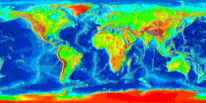
overall DEM notes is the same text attached to world image below: Etopo5 dem Data Information.
DEM data sources and ideas ~ todo list .txt TEXT file
.tpcfg Read Me .txt Text file
.tpcfg file howto
Map Projection parameters another way
Map Projection parameters another way
Map projection parameters
Map Projection input ranges


 Copyright © 1991..2011 by Ivan Lee Herring


